


承袭经典 风采自若
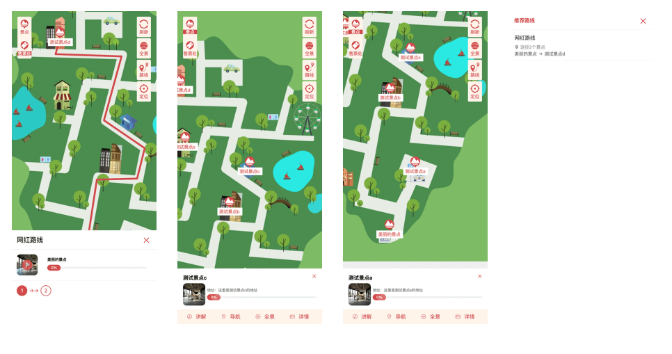
A multi map navigation system specially designed for upgrading scenic spots to 4A and 5A! This syste...
A multi map navigation system specially designed for upgrading scenic spots to 4A and 5A! This system is developed based on PHP and is only compatible with the H5 end,
Its advanced version also supports panoramic function, bringing a new experience to scenic area tourism.
The front-end of the system adopts a modern technology stack and has been comprehensively rewritten using Vite, TypeScript, and Vue3,
Significantly improved front-end development efficiency and performance. The most crucial thing is that the system supports private deployment,
Fully meet the needs of scenic spots for data security and personalized customization.

It is developed based on the open-source map engine OpenLayers, and the stored coordinate system is the WGS-84 coordinate system.
Based on the OpenLayers map, the range that can be zoomed in and out is 0-28, which can display smaller terrains
The referenced tiles from Gaode are mainly used in the backend for reference only and are for approximate positioning,
Due to the fact that Gaode is based on the Mars coordinate system, there may be a deviation from the coordinates of WGS-84, so we can only have a rough idea of the location.


You can send us a general question inquiry here
LINKS


+86-0132-9008-2757
consult
top